3. GPS Applications
Georeferencing or Geocoding (2/2)
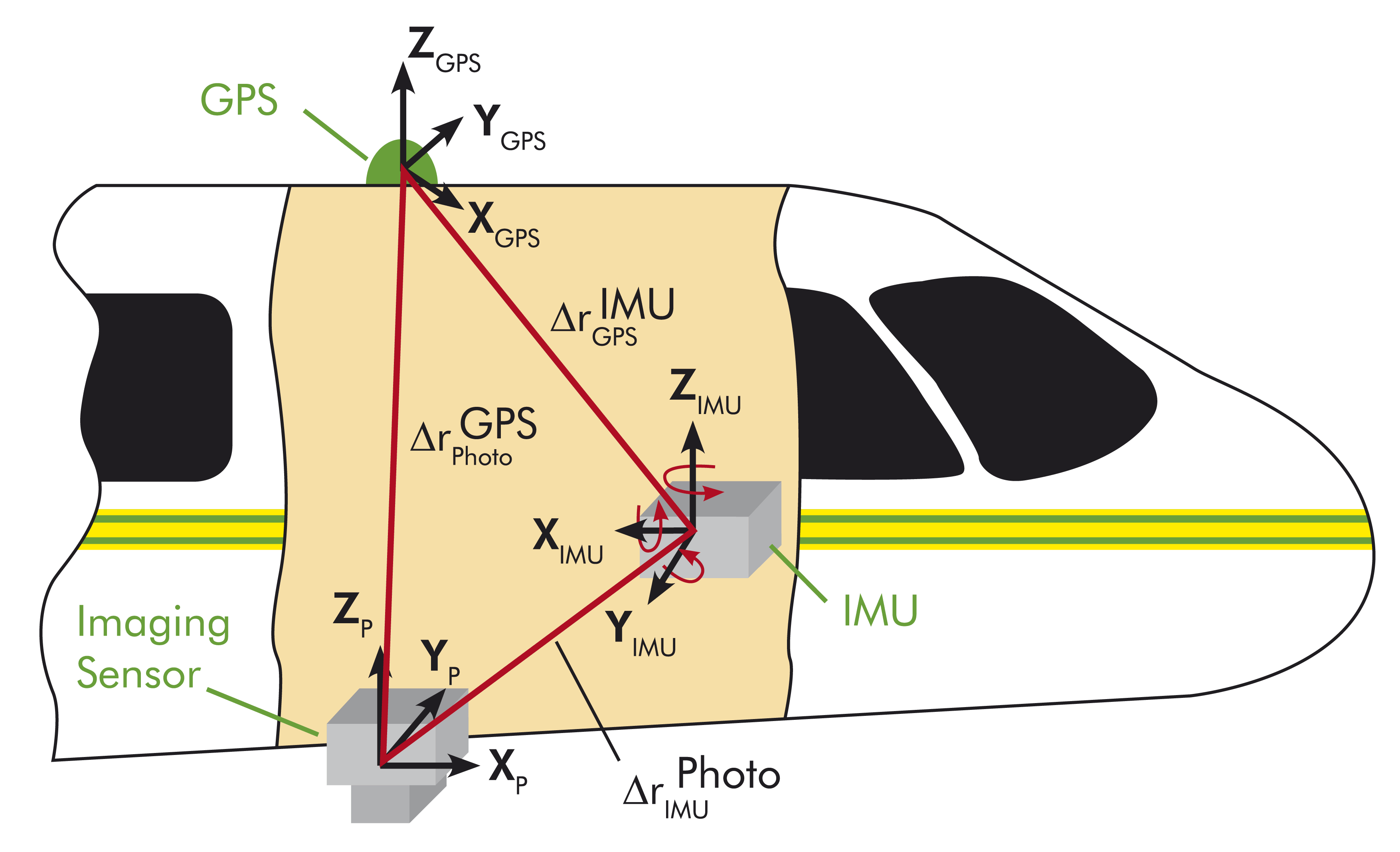
The use of GPS-data allows a direct measurement of the position of the multispectral scanner at the time of recording, enabling the correction and adjustment of the images with respect to position or bearing of the aircraft at a latter time.
The constantly changing position of the GPS over a period of time is taken into account when computing the velocity of the aircraft. In Geocoding, the GPS is combined with so-called intertial measuring units (IMU). These are sensors which help to measure the linear acceleration and rotary motion along the longitudinal and lateral axis of the aircraft. Thus, data about the position and bearing of the aircraft are also available, and these data can be combined with the GPS-position data.
The principle of Geocoding is interrelating a positon or location on the Earth's surface
with data obtained from a moving object (an aircraft or a satellite) in order to deliver an accurate
image of the Earth's surface. Geocoding is necessary for eliminating geometrical distortions on
image data. This process is also known as recitification.
During a measurement, all three systems - GPS, IMU and the Sensor (see illustration on the left) - must be properly calibrated. The integrierte Sensororientierung or ISO plays an important role in the overall calibration because it takes into account the correlations between the different calibration parameters and the accuracy of the position, velocity and bearing angle of the sensor.
Source: Alfred-Wegener-Institut für Polar- und Meeresforschung, Bremerhaven
