Mexico City (1/3)
Source: Wikimedia
Mexico City is one of the fastest growing megalopolis cities in the world. Founded in 1325 in the highlands of Mexico, the city is surrounded on three sides by mountains and volcanos on high plains. The city's boundaries are unclear and stretch out over nearly the whole basin. As the capital of Mexico, the city is the largest industrial site, the most important junction, the cultural centre of the country and the historical inner city has a UNESCO cultural world heritage designation. Mexico City today is also a noisy, crowded, traffic-congested central city, dominated by high-rises and encircled by hundreds of slums (Bauer et al. 2005, Claaßen 2008, De Blij, Murphy 2003, UNEP).
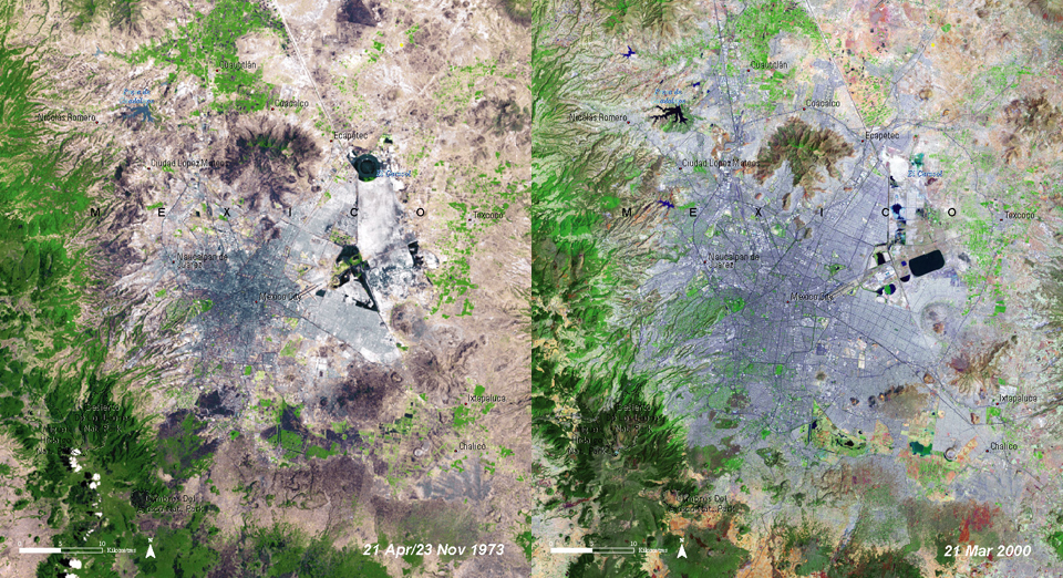
Source: UNEP
Task: Compare the two satellite images of Mexico City. In which direction did the city spread? Can you think of reasons for that?
In 1973 Mexico City had a population of about 9 million. By 1986, Mexico City's population had soared to 14 million. In 1999, Mexico City had a population of 17.9 million, making it the second largest metropolitan area in the world behind Tokyo. The Mexican capital is now expected to grow to 25 million inhabitants. This rapid urban growth has produced nearly unsolvable environmental problems (Appleby 2007, Claaßen 2008, UNEP).
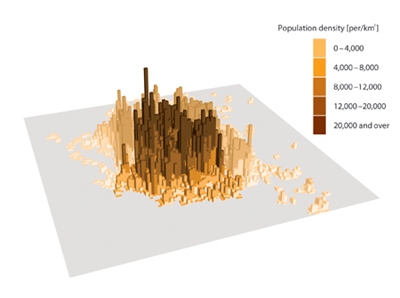
Source: The Urban Age Project
The population and the urbanised area of Mexico City have expanded dramatically since the mid-twentieth century. Both continue to grow in complex patterns - whereas the urban core has regained some population, suburban sprawl continues rapidly. The Federal District covers about 1,484 km². In the urbanised northern sector, open and recreational space is scarce. The gross residential density of the Federal District is about 5,900 people per km² (The Urban Age Project).
