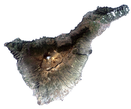
Satellite image of Tenerife in 2002.
Source: Landsat
Source: Landsat
Tasks:
1. Mark on the above image the areas where land use change is most visible when comparing the classifications of 1978 and 2002 (see: landuse-c04-p02.html).
2. What could be the reasons for these changes? Follow especially the progress of development.