What is Remote Sensing?
Remote sensing is used to obtain information about objects. Data is collected with an instrument an then analysed. The instrument used is not in direct contact with the object. The platforms used are located "at a distance" from the earth’s surface (for example, aircraft and satellites). These carry sensors to observe and study the earth, its land surface, the oceans, the atmosphere and the earth's dynamics from space (ESA Eduspace).
This tutorial teaches the basics of remote sensing:
- Physical basics: the electromagnetic spectrum, atmospheric influences and spectral reflectance properties
- Satellite systems with different sensors and orbits, followed by an overview of exemplary earth observation satellites
- Geometric, spectral, radiometric and temporal resolutions
- Visual image interpretation of satellite images
- Image processing and enhancement techniques
- Classification techniques like unsupervised and supervised classification
Click on one of the images above to go directly to a specific chapter! A detailed table of contents follows on the next webpage.

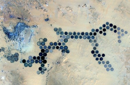
What are the blue circles?
Source: infres.enst.fr
Source: infres.enst.fr
Is that alien made? What are the blue circles?
Answer (think first, then click here!)


