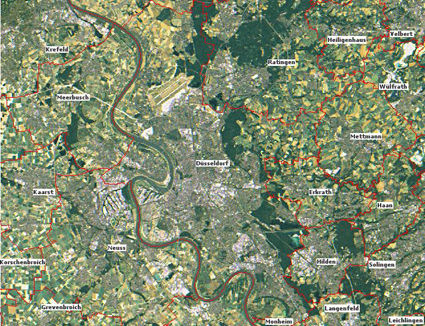
Düsseldorf in a satellite image.
Source: www.flaechennutzung.nrw.de
Source: www.flaechennutzung.nrw.de
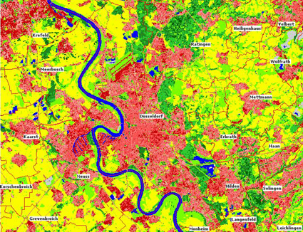
Düsseldorf on an classified image.
Source: www.flaechennutzung.nrw.de
Source: www.flaechennutzung.nrw.de
Tasks
- Please compile the legend by adding the right colour to the 10 land cover classes. Following colours are given: yellow - light green - medium red - blue - lime green - dark red - grey - light red - dark green - medium green
- Estimate the area percentage of each land cover class (be sure not to exceed 100% in total)
- Name reasons why a classification is useful.
- True colour satellite image or classified image? Name advantages and disadvantages of true colour and classified satellite images and where they are most useful.
| Legend class | Colour | Area percentage |
| High degree of sealing (> 80%) | ||
| Medium degree of sealing (40 - 80%) | ||
| Low degree of sealing (< 40%) | ||
| Waste deposit sites, gravel-pits, building sites | - | |
| Agricultural land | ||
| Grassland and pasture | ||
| Coniferous forest | ||
| Mixed forest | ||
| Deciduous forest | ||
| Water bodies |
