3. Duurzaam bosbeheer (in het Engels)
Deforestation
Remote sensing has the advantage of providing data over a large area. Depending on the satellite platform and sensor, the area captured by the sensor can be from 10 to hundreds of kilometers wide. Of course there is usually a trade off between spatial resolution and the size of the sensor's field of view (see here for more information).
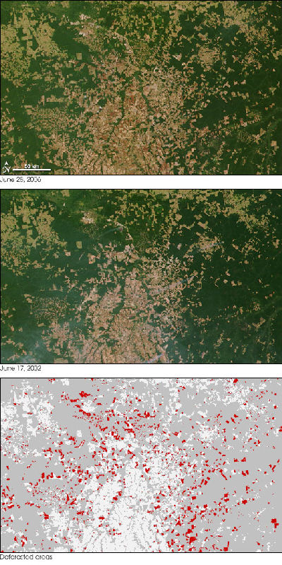
In some cases, remotely sensed data require minimal processing, before information can be extracted. On the example on the right, you can see the extent of deforestation in Brazil within 4 years, from 2002 to 2006. Simply by looking at the first two images, the difference is very much evident. The extent of the deforestation can be presented in more detail if the two images are classified, in order to identify forest cover in each of them, and then locate the areas where there was forest in 2002, but no longer exists in 2006. The results of this comparison are shown in the bottom image.
Because forest and bare soil have very different spectral signatures, it is very easy for the classification process to differenciate between the two, even when very few bands are available for the classification. Vegetation has very low reflectance in the visible, with the exception of green where it is slightly higher, and very high near-infrared reflectance. On the other hand, the reflectance of the soil steadily increases with the increase of wavelengths, forming a line known as the soil line. By simply using the red band (where chlorophyll causes vegetation reflectance to be very low) and the near-infrared band (where plant cells increase the reflectance), it is simple to distinguish forests from bare soil.
So why is deforestation so intense in Brazil? The main reason for cutting down forests, is to convert the land into arable land, pastures or even for urban use. High demand for food and high profits from agriculture promote the illegal cutting of forest, in order for the area to be used for agriculture.
Brazil is not the only area in the world where deforestation is advancing at an alarming pace. Tropical forests have been significantly reduced in China, Thailand, Malaysia, Philippines, Sri Lanka, Nigeria, Liberia, Ghana, and many other countries near the Earth's equator.
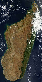
In Madagascar, off the south-west coast of Africa, 95% of its original rainforests are now lost. As a result, it is now suffering from desertification and soil loss, which has led to water resources problems, as there are no forests to withhold the water in the soil. The current food and water resources are not sufficient to support the increasing population.


